About This Event
A fascinating 8 mile historical hike along the Old Stagecoach Road. In 1859, the state put up $15,000 to fix up the Santa Susana Pass Wagon Road, under the supervision of James P. Thompson. Thompson was also the man awarded the contract to use the pass for carrying mail. The first overland stagecoach to use the pass made its run between San Francisco and Los Angeles on April 6, 1861. The trip took 72 hours. There were several stagecoach lines but this route from San Francisco through the Santa Susana Pass, Between Simi Valley and Chatsworth, was the most steep and dangerous.
The pass on the Chatsworth side was called "The Devils Slide", and for good reason. The road was carved out of the sandstone rock by hand (you can still see the pick marks), and holes were drilled so that steel pins were set so that block and tackle could ease the coaches down the grade. Here are some photos from a couple of previous trips in 2009 and 2010
http://www.meetup.com/localhikers/photos/all_photos/?photoAlbumId=1170260
http://www.meetup.com... (http://www.meetup.com/localhikers/photos/756319/)
http://farm4.static.flickr.com/3131/3145753819_d02b186528.jpg Looking down Devils Slide. Note the holes for the winches and the steps for the horses.
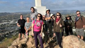
One of the highlights along the way is a plaque set by the Native Daughters of the Golden West in 1939 marking Devils Slide.
http://photos3.meetupstatic.com/photos/event/3/7/1/highres_19800881.jpeg
This photo is from movie film footage captured at the 1939 dedication ceremony
The observant hiker will notice the drainage chutes along the side of the road, old cisterns used to capture rainwater, and notches carved out from the wear of wagon wheels. There are petroglyphs to be found on some of the rocks along the trail if you look carefully.
We will end up in Corriganville Park on the Simi side. The park contains a 2.5 mile loop that meanders down an oak shaded trail on both sides of a small creek. Interpretive signs detail both nature and the 3500 movies made at this location almost 40 years ago. The loop then continues through some spectacular sandstone formations. We'll enjoy a snack break here and return nearly the way we came.
We'll be taking our snack break by the remnants of this building -- "The New Barn." Note the stone parts, its all that is left to see now.
Total elevation gain is about 1200 feet.
Directions
Go west on Devonshire as if you are going to Chatsworth Park. Instead of driving into the (closed) park entrance, turn left (south) on Larwin Street and go one block until you come to a chain link fence on your right. This is very easy to locate because in addition to the fence, an old set of power lines runs directly overhead. Park along the curb. We will enter the park through a gap in the fence.