About This Event
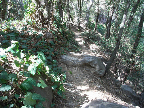
A lush and shady loop on multiple trails through one of the most picturesque and popular canyons in the San Gabriels. Multiple stream crossings, river cascades, shaded canyons and a 50 foot waterfall give way to thick forests, vine-covered trails, Jeffrey Pines, and eventually chaparral slopes of the front range.
The landscape is populated by turn-of-the-century Forest Service canyons, a few campgrounds, and an old outdoor resort. We will see many cabins by the trail and nestled among the oak, bay, and alder trees along the way. These privately owned cabins were constructed individually from the 1890’s through the mid-1920’s
See brochure (https://files.meetup.com/454296/Big%20Santa%20Anita%20Canyon.pdf) in Files section
This place is packed on the weekends -- do it with us weekdayers!
Hike is 9.5 miles with about 1900 ft net elevation gain. Bring plenty of water, snacks and a camera
To get there:
From the Foothill Freeway (210) in Arcadia, exit on Santa Anita Avenue and drive six miles north to its end at Chantry Flat. (Street changes names to Santa Anita Canyon Rd)
GPS coordinates: 34.195662,-118.022443
Google Map Street View (https://maps.google.com/maps?f=q&hl=en&geocode=&q=chantry+flat,+ca&layer=c&ie=UTF8&ll=34.22,-118.018484&spn=0.049326,0.094671&z=14&cbll=34.19527,-118.022364&panoid=WFTCWmfSmwf4fsWbipXJmg&cbp=2,378.71000000000003,,0,5)
Parking
Parking requires an Adventure Pass. They are $5.00 and can be purchased from many sources including Sports Chalet, REI, various web sites and at Chantry Flat. See the US Forest Service web site (https://www.fs.fed.us/r5/sanbernardino/ap/welcome.shtml). It is not recommended you purchase the pass at Chantry Flat since that may delay the hike starting time.