About This Event
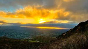
Cheeseboro Canyon is located in the northernmost section of the Santa Monica Mountains National Recreation Area. It is from these hills that water in the canyons flow to the Pacific. The Chumash Indians lived in these canyons for thousands of years. Many trails within the canyons were original Chumash trails before they were expanded by cattle ranchers. In this large expanse of habitat, deer, bobcats, coyotes and rabbits roam. Stroll to Sulphur Springs or hike to the top of Simi Peak and view the cities you?ve left behind. Walk quietly amid the oaks and grasses, or picnic beside a streambed.
Today, a great diversity of plants and animals live in the canyons. Wide-spread oaks and outcrops of sedimentary rock provide excellent nesting sites for owls, hawks and other raptors (birds of prey). The abundance of raptors indicates a large prey population, especially small mammals and reptiles. In more rugged areas where cattle didn?t graze, we can still find a variety of native plant communities, including chaparral, coastal sage scrub and riparian woodlands.
There are several unique facts regarding these canyons:
--Cheeseboro Canyon has the largest concentrations of birds of prey nesting areas in the U.S. outside of Alaska. --The Valley Oak tree, the largest oak native to the United States and possibly the world, live in these canyons in what might be the largest southerly stand of trees left.
Directions To Trailhead:
From the East:
--From 101 North/West, take Cheseboro Rd exit and make a right turn on Palo Comado --Curve around to the left and make a right on Cheseboro Cyn Rd (Welcome to Old Agoura) --Continue north about a half mile, cross a narrow bridge and turn right into park entrance (Welcome to Agoura Hills) --Drive up this road to the end and park in parking lot.
From The West:
--From 101 East, get off at Cheseboro Rd, cross Dorothy and make a left on Palo Comado. --Continue on Palo Comado back over the Freeeway and make a right on Cheseboro Rd as above.
=============================================================
Hike is 8-9 miles loop. Shorter options are possible
Bring at least 2 qts water, food, hiking shoes
Our hike will include the following trails:
Modelo Spur: 0.7 mile, moderate hiking trail meanders from the parking lot through grasslands to a lone coast live oak on the ridge. The trail drops east and joins the Cheeseboro Canyon Trail, buit we willl continue onto the Modelo Trail.
Modelo Trail: 1 mile, easy hiking trail starting at the ridge line of the Modelo Spur and continuing north along the ridge. This pathway offers views of both Cheeseboro and Palo Comado Canyons. It ends at the Palo Comado Connector Trail where you can turn right, and travel east to Cheeseboro Canyon, or left, and travel west to Palo Comado Canyon. We will turn east
Cheeseboro Canyon Trail / Sulphur Springs Trail: 4.6 miles, easy. Follow an old ranch road along a streambed through a valley oak savannah and coast live oak riparian zone. A picnic area is located 1.6 miles from the parking lot. Near Sulphur Springs, at 3.3 miles, you can smell the odor of sulfur. As you pass under the Baleen Wall, the canyon opens up and chaparral slopes replace the savannah. The trail continues to an old sheep corral where we can picnic near the creek bed or watch the sky for birds of prey.
We will return along the eastern Cheeseboro Ridge.
See brochure here: https://files.meetup.c... (https://files.meetup.com/454296/Cheeseboro.pdf)