About This Event
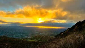
http://photos1.meetupstatic.com/photos/event/b/9/f/8/600_442307608.jpeg Temescal Canyon is a very popular hiking spot with great views of the ocean and LA basin on clear days, a seasonal waterfall, and a densely wooded canyon. This looped hike is a nice workout at about 5 miles with a net elevation gain of about 1,200 ft.
But this won't be your typical Temescal trek!
We'll begin at the lower end of the first parking lot and walk along Temescal Creek on the Sunset Trail. After 0.4 miles we'll head up the Ridge Trail under chaparral arches with some nice views of the Palisades and the Pacific Ocean beyond.
Post hike lunch will be at Matthew’s Garden Cafe http://www.matthewsgardencafe.com/ 859 1/2 Swarthmore Ave Pacific Palisades, CA 90272
Its only a couple blocks away: Map https://goo.gl/maps/NFxjTuufZ552
The Reverend Dr. Charles Holmes Scott developed what is now Temescal Gateway Park for the Methodist Church in 1922 as a West Coast center for the Chautauqua movement. Originated in 1874 on the shores of Chautauqua Lake in Southwestern New York State, Chautauqua assemblies were aimed at challenging the minds and spirits of its participants by offering families seasonal programs of lectures, music, elocution, and open discussion of public issues, literature, and science. Some of the canyon's earliest structures are still in use. Built in 1922, the building known as the Temescal Camp Store was two buildings-- a grocery store complete with a butcher shop, and the local post office. The Presbyterian Synod purchased the property in 1943 and used it as a private retreat center until the Santa Monica Mountains Conservancy purchased the property in 1994
http://photos4.meetupstatic.com/photos/event/9/f/0/7/highres_439180711.jpeg
http://photos2.meetupstatic.com/photos/event/b/c/f/e/event_90288382.jpeg
http://photos3.meetupstatic.com/photos/event/9/b/8/f/highres_439179823.jpeg
http://photos4.meetupstatic.com/photos/event/5/f/f/c/highres_412344572.jpeg
Directions
Temescal Gateway Park is located in Pacific Palisades, just one mile north of Pacific Coast Highway at the intersection of Temescal Canyon Road and Sunset Boulevard.
Park for free on Sunset or Temescal, or enter park and use the first pay lot on the left. Meet outside park on NW corner under Park Sign
Click for Picture of Corner (http://photos3.meetupstatic.com/photos/event/6/c/2/2/highres_140607682.jpeg)
From Los Angeles, take the Santa Monica Freeway (10) West until it becomes Pacific Coast Highway(PCH). Continue West on PCH. Turn right (North) on Temescal Canyon Road and continue for 1 mile. Park on street
From the Conejo and San Fernando Valley, take Topanga Canyon Boulevard South to Pacific Coast highway(PCH). Turn left (East) on PCH. Go Left (North) on Temescal Canyon Road and continue for 1 mile. Park on street
The Organizers and members of Hiking With Dean are not professional leaders, guides, or mountaineers. The function of the member or organizer is only to organize the trip. Each person who shows up for a trip/meetup (and their guest or guests) is responsible for his or her own safety. By attending a hike, or any other event organized by this group, you are acknowledging that you and any guests that you bring are aware of the risks, dangers and hazards associated with the activity and freely accept and fully assume all such risks, dangers and hazards, and further agree to release and discharge the Organizers, Members of the Hiking With Dean Meetup Group from and against any and all liability arising from your participation in the group activities per our ASSUMPTION OF RISK AND LIABILITY WAIVER and Section 6.2 of the Meetup.com Terms of Service.