About This Event
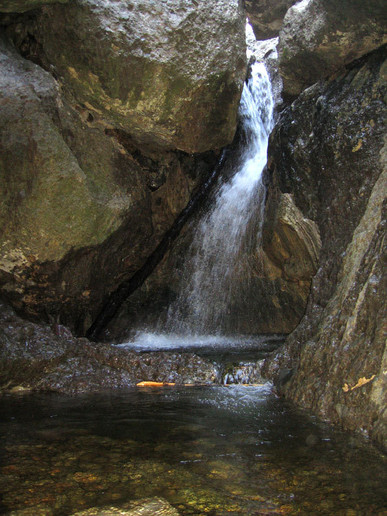
The Grotto is a maze of large volcanic boulders in a sheer, narrow stream-cut gorge formed from landslides. The West Fork of Arroyo Sequit flows through the caves and caverns of The Grotto, creating cascades and pools. It’s one of the most pleasant hideaways in the Santa Monica Mountains.
https://lh3.ggpht.com/_pV9gLXNgXmI/TRIX4QO7ZnI/AAAAAAAAAEA/_su7pGy1B58/Grotto_8004.jpgAt the base of the grotto, the water tumbles off a rock like a shower head, dropping twelve feet into an enclosed pool. Here a ring of shallow water around a tall rock creates a tube-like semi-circular cave.
https://farm5.static.flickr.com/4063/4482906241_5f6fd0279b.jpgDeep inside the grotto
Back in July 2009 during a TO Hikers hike Tina took a bone-crushing tumble off the rocks above the grotto. So for her birthday we will return her to the same spot -- hopefully not to relive the incident -- and show her the proper way down to the grotto
https://photos4.meetupstatic.com/photos/event/6/3/2/d/event_9745389.jpegTina's rescue helicopter. It took one hour and fifteen minutes from fall to rescue. If they made a movie out of it, it would be called "1.27 Hours" (Photo courtesy of Jan and the TO hikers)
The typical Grotto hike is about 3 miles and starts out at Circle X Ranch. Unsurprisingly we will not do the typical hike -- we'll leave that one to the weekend masses. Instead we'll start out on the Canyon View Trail near the Sandstone Peak trailhead making the hike about 7 miles. There is a "upside down" 900' elevation gain.
Parking lot is on the north side of Yerba Buena Rd, 4.5 miles west of Mulholland or 6.4 miles north of PCH (1 mile past Circle X park office). Yerba Buena is very curvey so drive carfefully.
Recommended routes:
From points east of Westlake Village, exit 101 at Kanan and go south to Mulholland. Turn west (right) to Yerba Buena
From the 101:
Exit and turn south at CA-23 (Westlake Blvd) Continue to follow CA-23 south 5.2 mi. Continue straight toward Mulholland Hwy West After a couple more miles, turn right at stop sign and continue west on Mulholland Hwy 0.4 mi Turn right at Little Sycamore Canyon Rd 1.9 mi Slight left at Yerba Buena Rd 2.7 mi
Sandstone Peak Trailhead will be on right (There is a sign there. There are a couple turnouts along the way. If you are on a turnout without the sign you are in the wrong place)
Bring at least 2 qts water, lugsoles, hat, sunscreen camera and snacks.