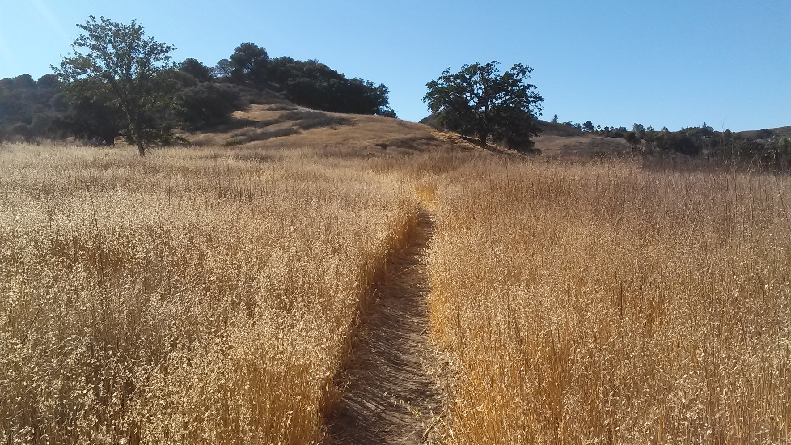
Fit Beginner, 4.1 miles, 720' gain. Easier route: 3.9 miles, 500' gain. Is it Talepop or Talopop? Maps and signs that I have seen, use the 2nd spelling, but a lot of references use the other. We'll meet in front of the facilities building at the center of the park. This is a lollipop hike....
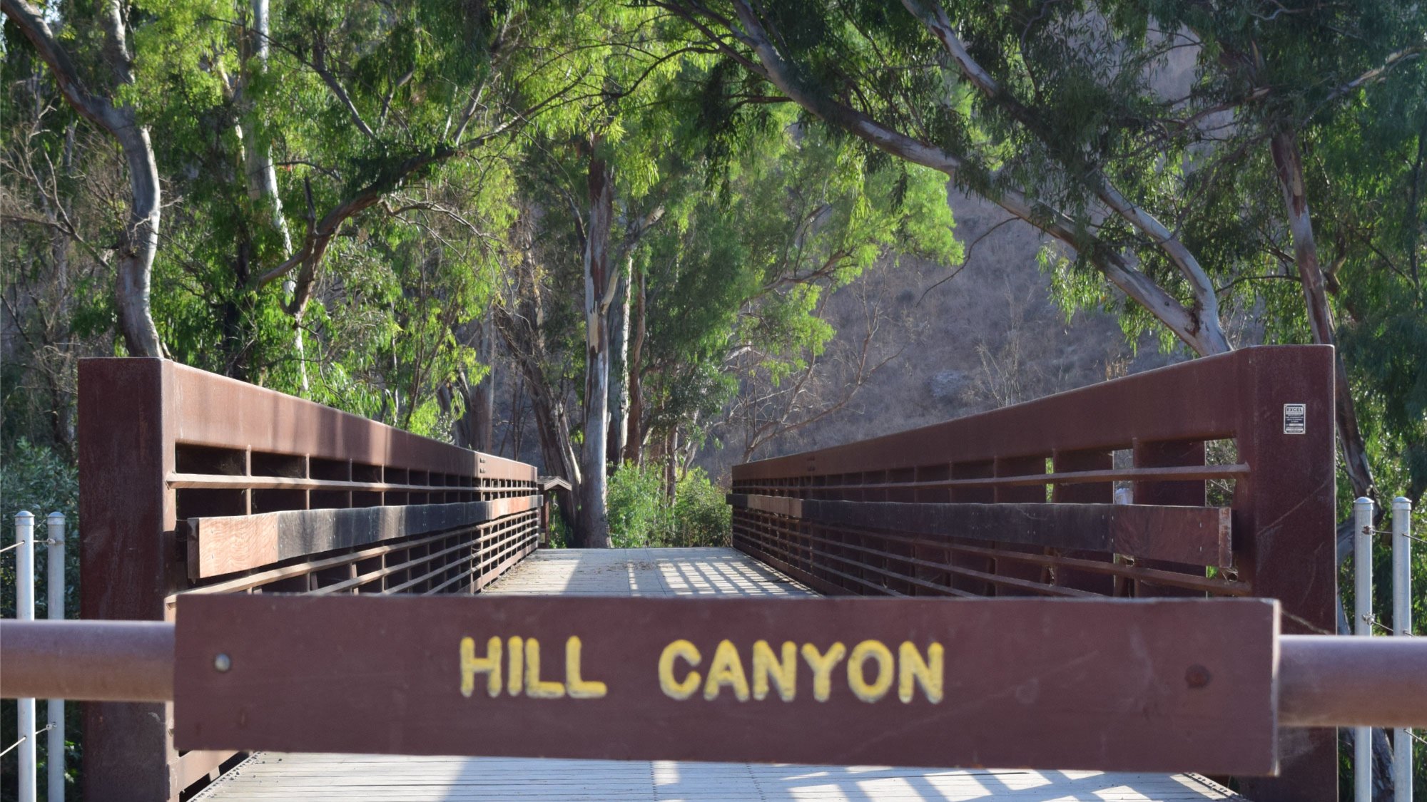
This is a fit beginner to moderate 4.3-mile hike with about a 300' gradual elevation gain and no steep terrain. Park in the dirt parking lot and meet me at the Hill Canyon Bridge at 6:30. We'll wait about 5 minutes for late comers like me sometimes. The Hike My hikes are slow paced (1.5-2...
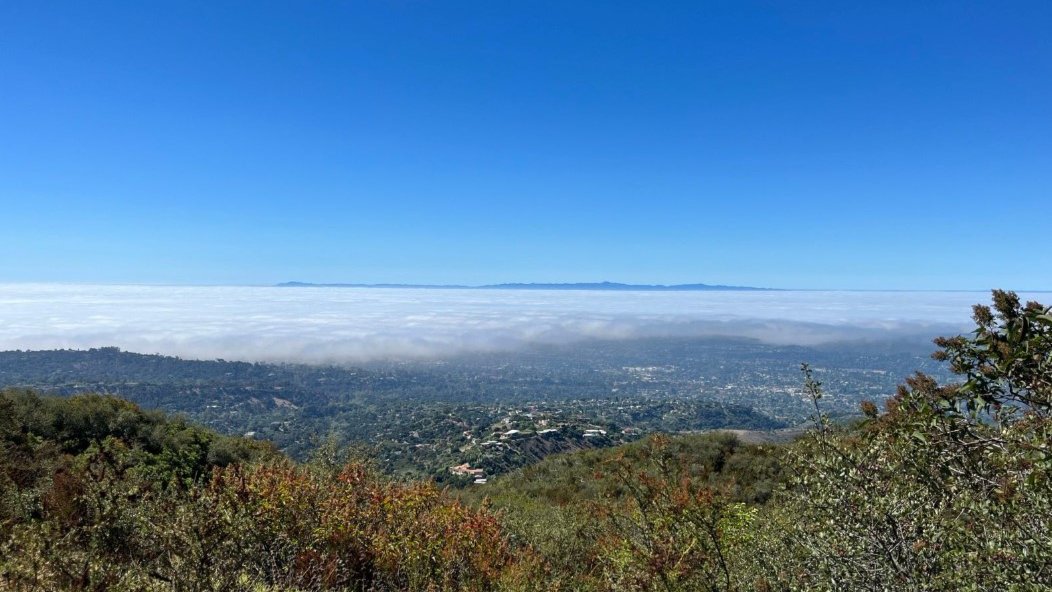
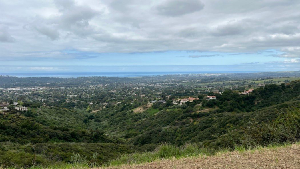
5:45 PM START TIME - WEDNESDAY NIGHT I've been get too much couch time lately and need to get my tuckus moving, so here we go... This is kind of my "go to" hike, it's on my way home, it's not too long and the views can be spectacular! This is a great weeknight hike,...
This week: Jesusita. Parking at the Cater Water Processing Plant/Jesusita Trailhead off San Roque Road. This route follows Jesusita Trail up to Inspiration Point. The route meanders through level ranch land before reaching a road and then ascending a well-trafficked trail up the south side including some switchbacks and then a traverse to a fire...
This is a moderate, out and back, 4+ miles hike with an elevation gain of about 865', The Hike My hikes are slow paced (1.5-2 mph) and the end time is approximate only. We take breaks, we explore, and we don't leave anyone behind. If this hike isn't for you, please find another that best...
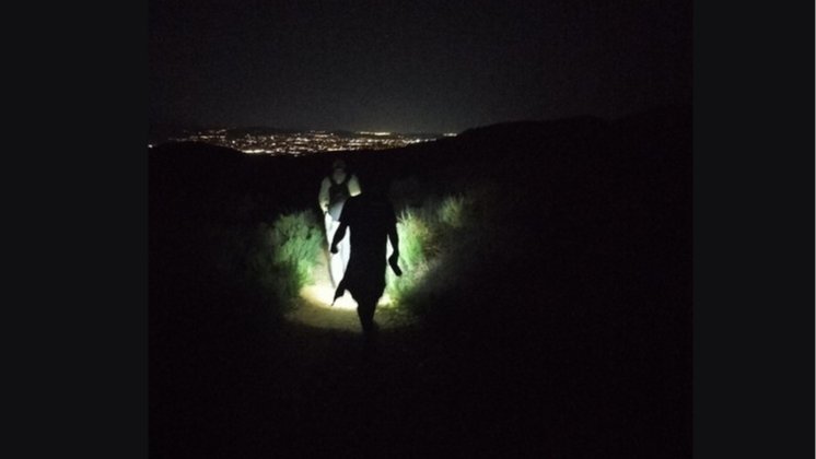
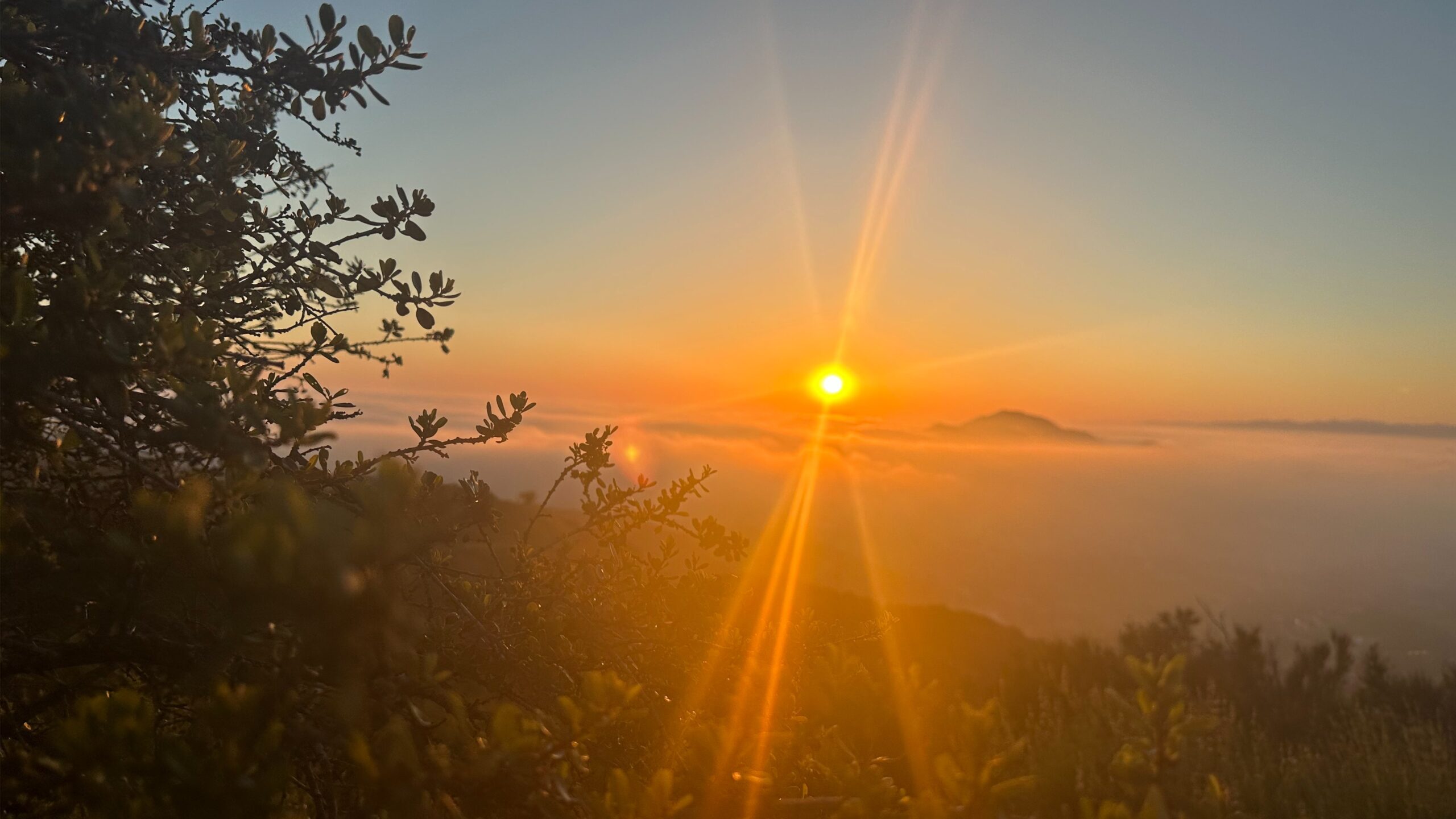
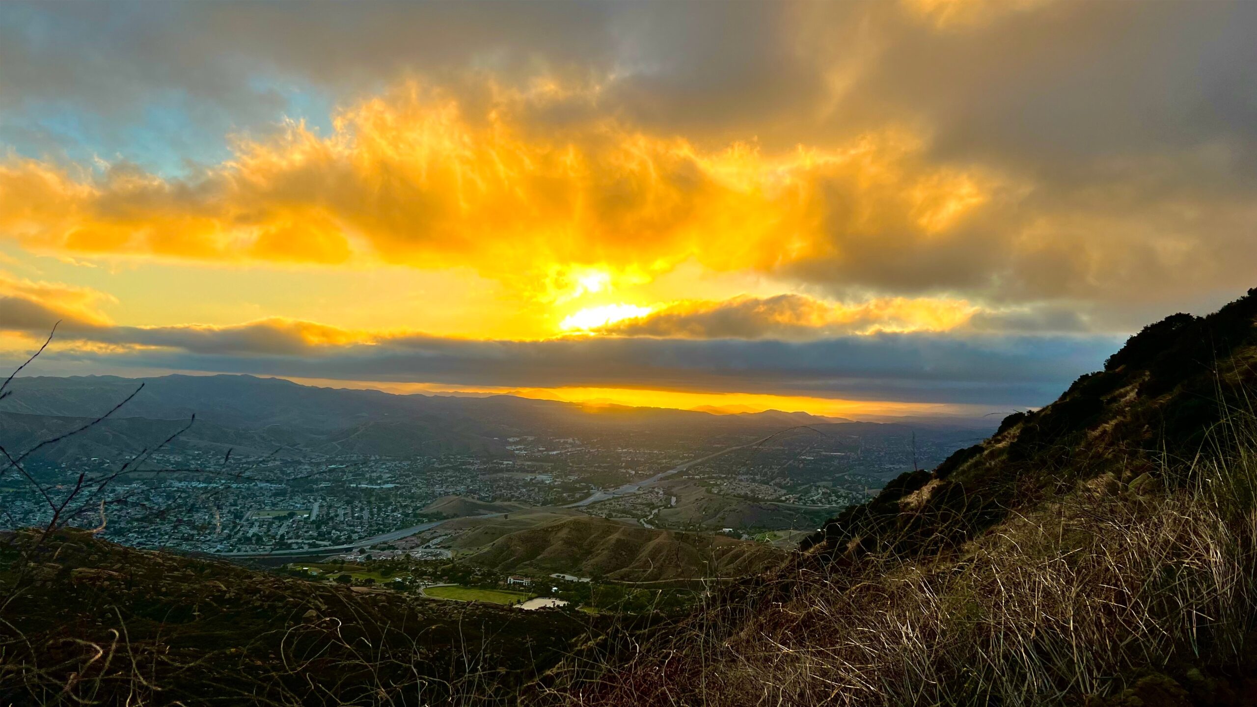
A silhouette following me down the Chumash. Looks Canadian. The pic is from the top of Chumash trail on Jan 15, 2025. Thank you Jimbo WhereAmEye (Tall Mark) has been doing this hike up the Chumash Trail in Simi Valley every Thursday night since the Jurassic Period, and he'll be leading this event until the...
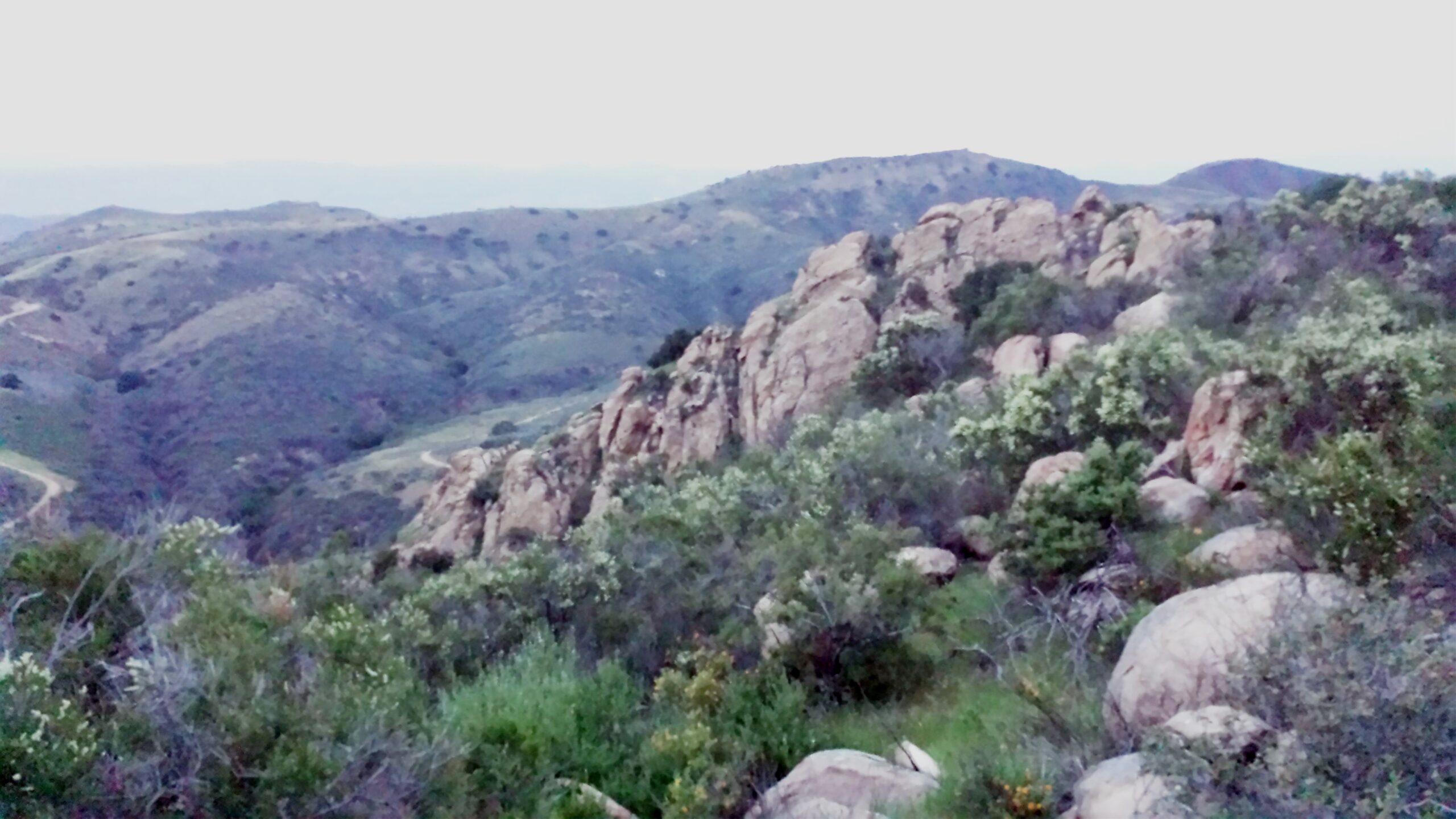
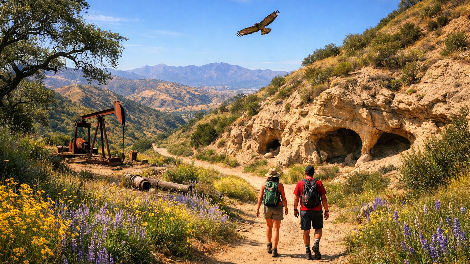
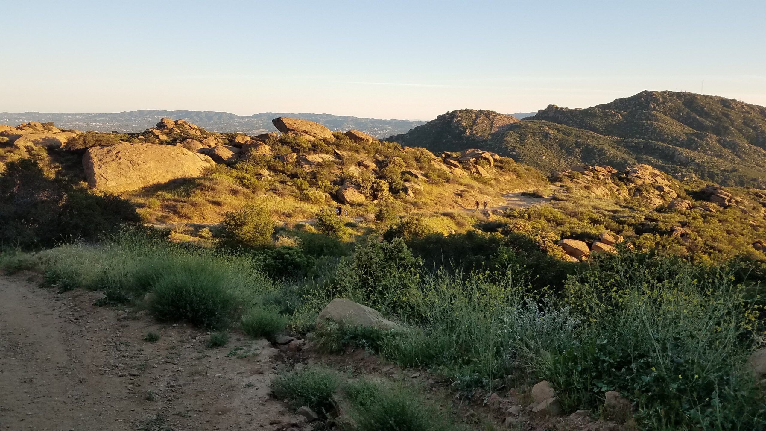
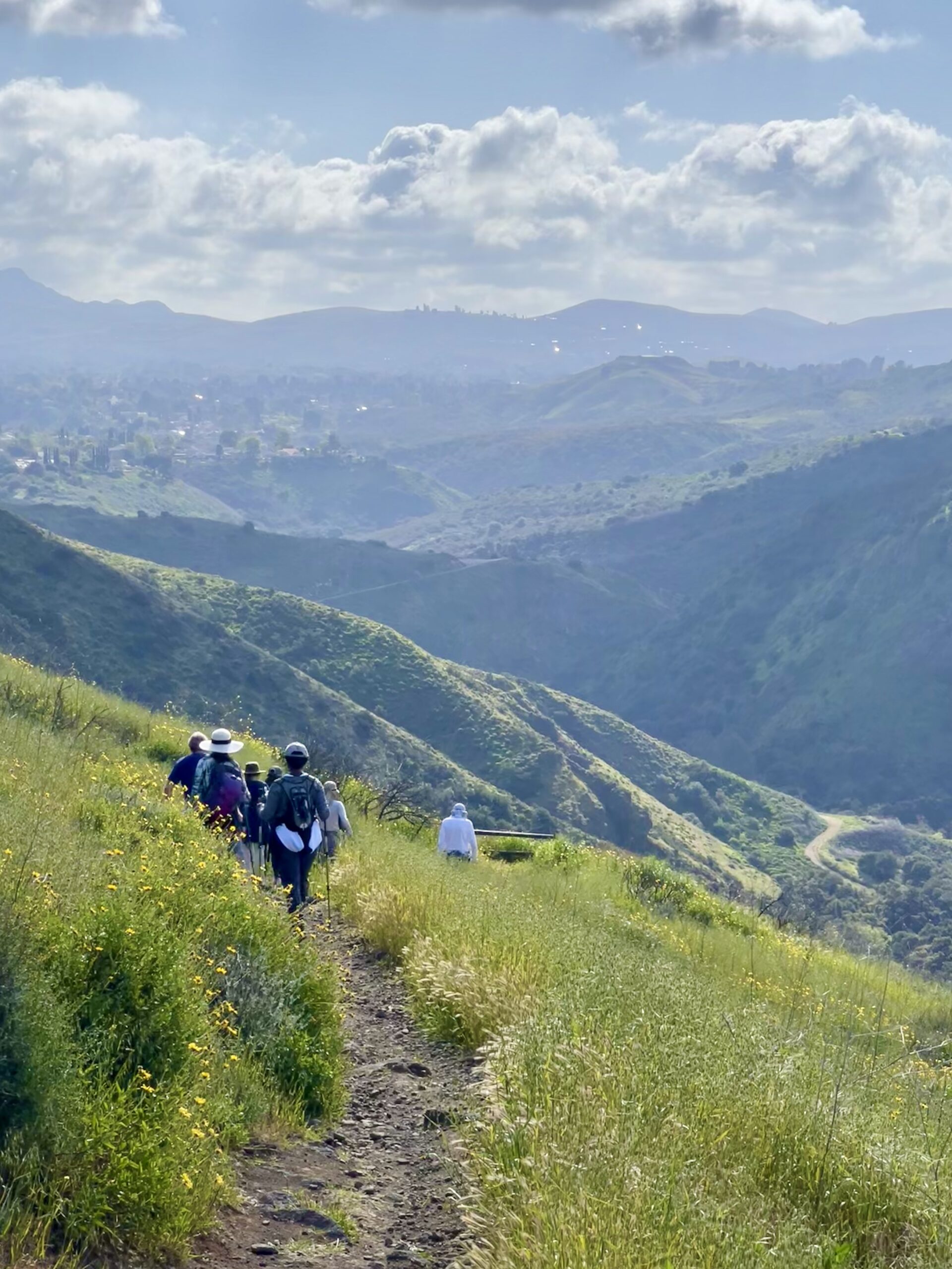
3.2 miles, 900' gain, Intermediate. The first part is a steady incline, followed by a rolling trail to our destination. Fit beginners can complete this hike, but it will certainly get their blood pumping. There are no super steep sections. This hike takes us to a secret spot below a large rock formation. Naturally into...
This outing follows a counterclockwise lollipop loop that blends wide canyon roads, singletrack, and ridgeline views for a well-rounded, moderate hike. We’ll start from the Rivendale Ranch trailhead and head up Towsley Canyon Road, an easy, gradual warm-up through oak-studded canyon bottoms. From there, we’ll turn onto the Towsley View Loop Trail, climbing steadily through...
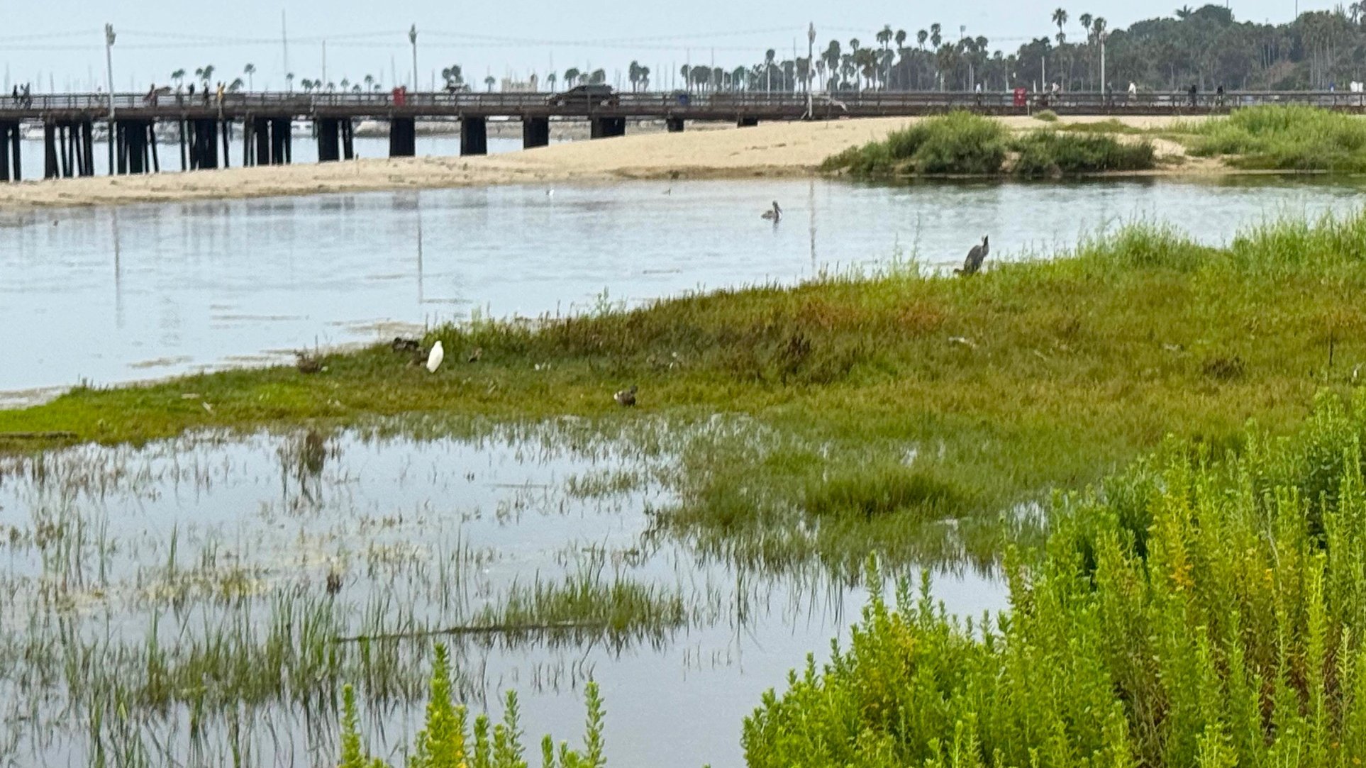
Join the members of the Urban Creeks Collective for a fun and helpful morning. We will thoroughly weed out invasive plants that are competing with our California native coastal habitat flora at the Mission Creek Lagoon restoration site. We will be staging in the back of the Palm Park Parking Lot near the bike path....
Stay cool on our bicycle ride on the beach bike path from Marina del Rey to Redondo Beach. There's always a cool breeze at the beach, so come and get some exercise. E-bikes are welcome too! This beautiful beach bike ride is 26 miles roundtrip on flat bike paths and roads. See a map of...
This is 5.2-mile loop hike with an elevation gain of 740'. The route is moderately challenging in some areas but suitable for fit beginner/intermediate levels. There is little shade for the most part. The Hike My hikes are slow paced (1.5-2 mph) and the end time is approximate only. We take breaks, we explore, and...
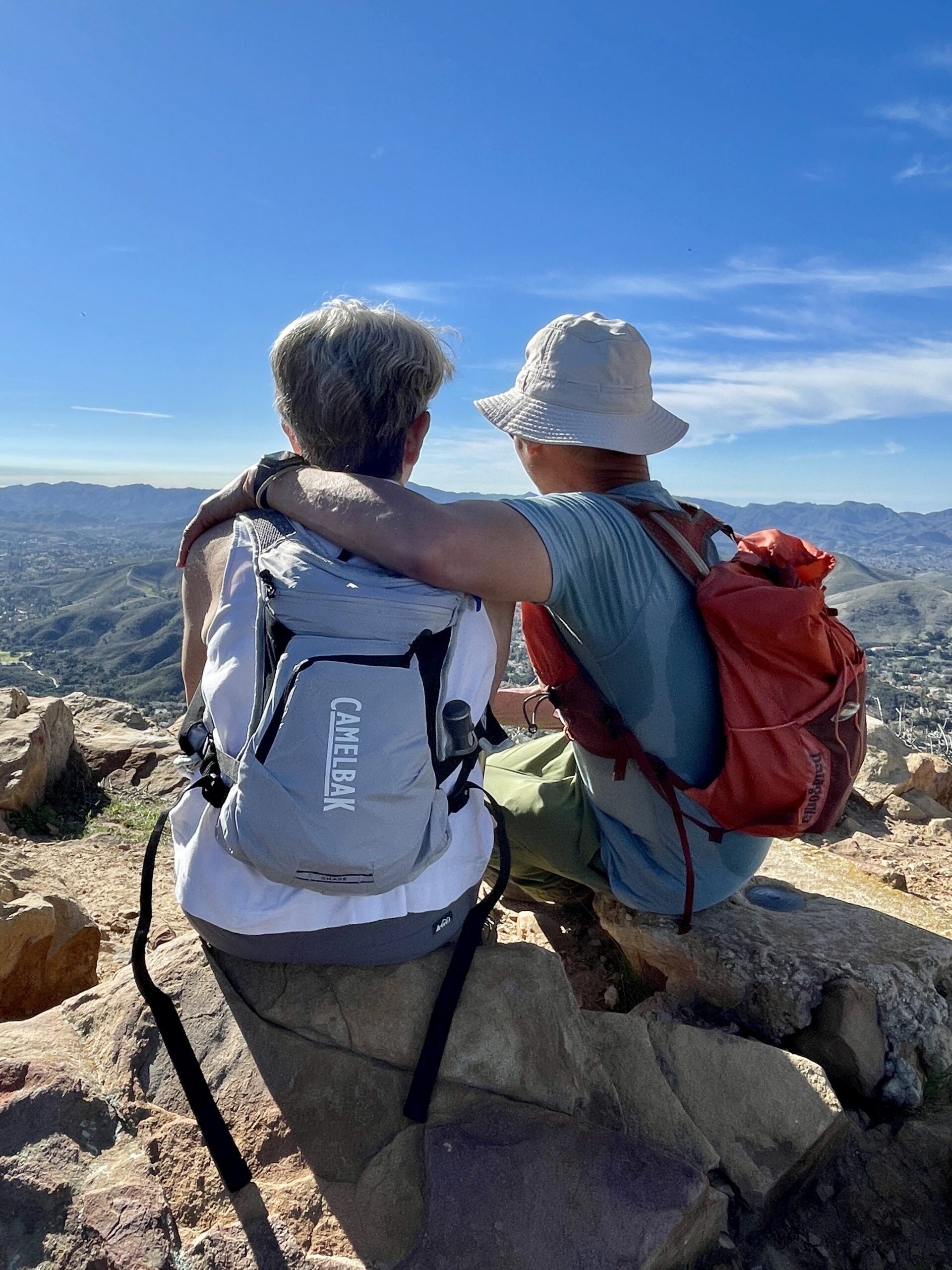
3.0 miles, 800' gain, easy-intermediate. Moonrise 6:34 pm, Sunset 5:25pm Photo by Helen Let's enjoy the gorgeous sunset, full moon, and fun loaded potluck picnic at the beautiful Angel Vista! This is a potluck hike. Please bring food, drinks to share. If your item requires utensils/plates/toothpicks, etc., please bring them. You may wish to bring...
377’ in/out Experience this 3.1-mile out-and-back trail near Agoura Hills, California. Generally considered an easy route, it takes an average of 1h 16 min to complete. This is a popular trail for hiking, horseback riding, and mountain biking. The trail is open year-round and is beautiful to visit anytime. Dogs are welcome, but must be...
5.4 miles, 1050' gain, Easy Intermediate This hike is one of the most beautiful hikes in Simi Valley. There are 3 extended inclines, about 1000 steps each, on fire road. They are not especially steep, but they do continue for some time, which is why it is rated "Easy Intermediate." There are also several small...
This is a relatively easy to moderate 4.5-mile hike (out and back) with an evenly distributed, gradual elevation gain of about 700'. The Hike My hikes are slow paced (1.5-2 mph) and the end time is approximate only. We take breaks, we explore, and we don't leave anyone behind. If this hike isn't for you,...
5:45 PM START TIME - WEDNESDAY NIGHT I've been get too much couch time lately and need to get my tuckus moving, so here we go... This is kind of my "go to" hike, it's on my way home, it's not too long and the views can be spectacular! This is a great weeknight hike,...
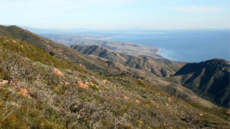
This week: Gaviota Peak. Meet at South Coast Railroad Museum at 6:00p for the shuttle to Trailhead. This route ascends the South side road and Trespass Trail to Gaviota Peak. The last mile gets pretty steep, so take your time so you don't gas. Trail offers great views of the Pacific Ocean and Gaviota Pass....
A silhouette following me down the Chumash. Looks Canadian. The pic is from the top of Chumash trail on Jan 15, 2025. Thank you Jimbo WhereAmEye (Tall Mark) has been doing this hike up the Chumash Trail in Simi Valley every Thursday night since the Jurassic Period, and he'll be leading this event until the...
4 miles, 950' gain, Intermediate 2 miles, 550', Fit Beginner Last year (2025), we celebrated here for our 1000th meetup event since the group started. We have such a great bunch of people that attend these hikes! This is a modified version of the famous Rocky Peak hike. It gives those that want something easier,...
Join us for a scenic bike ride on the beach bike path and road from Long Beach to the Newport Beach peninsula. We will continue on the ferry to Balboa Island and bike up to Inspiration Point in Corona del Mar. Please bring $4.50 in cash for the ferry to cross from Newport Beach peninsula...
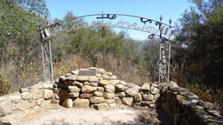
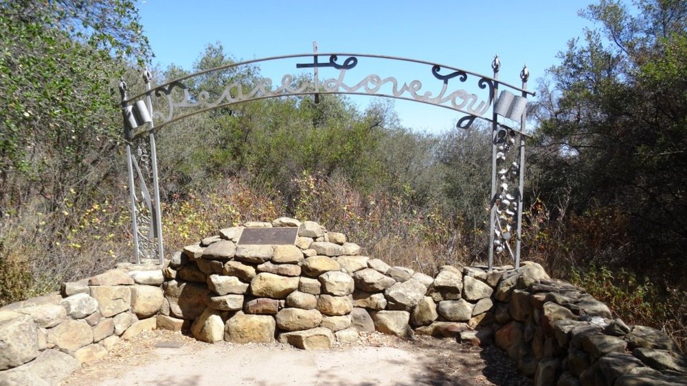
6.5 miles, 1300' gain, intermediate This hike is longer and harder than our regular hikes. We start at 3:00PM to make the most of the sunlight time. Beautiful spring is here! Let's enjoy hiking to the Danielson Monument in the Boney Mountain Wilderness, potluck, and "Peace, Love and Joy"! Please bring food and drinks to...
Beat the post holiday season doldrums with a hike up the Rocky Peak trail. Pic is Sunset on the Rocky Peak trail Oct 2023. Thank you Teka, WhereAmEye (Tall Mark) has been doing this hike in every Sunday afternoon for over 20 years, and he'll be leading this event as long as he keeps getting...
This hike begins from the top of King James Court, a cul-de-sac off Lindero Canyon Road. Begin up the trail at the top of the road, passing through a gate by a sign that reads “China Flat Trail Head.” It will pass through the branch of Suicide Trail and another branch of China Flat Trail....
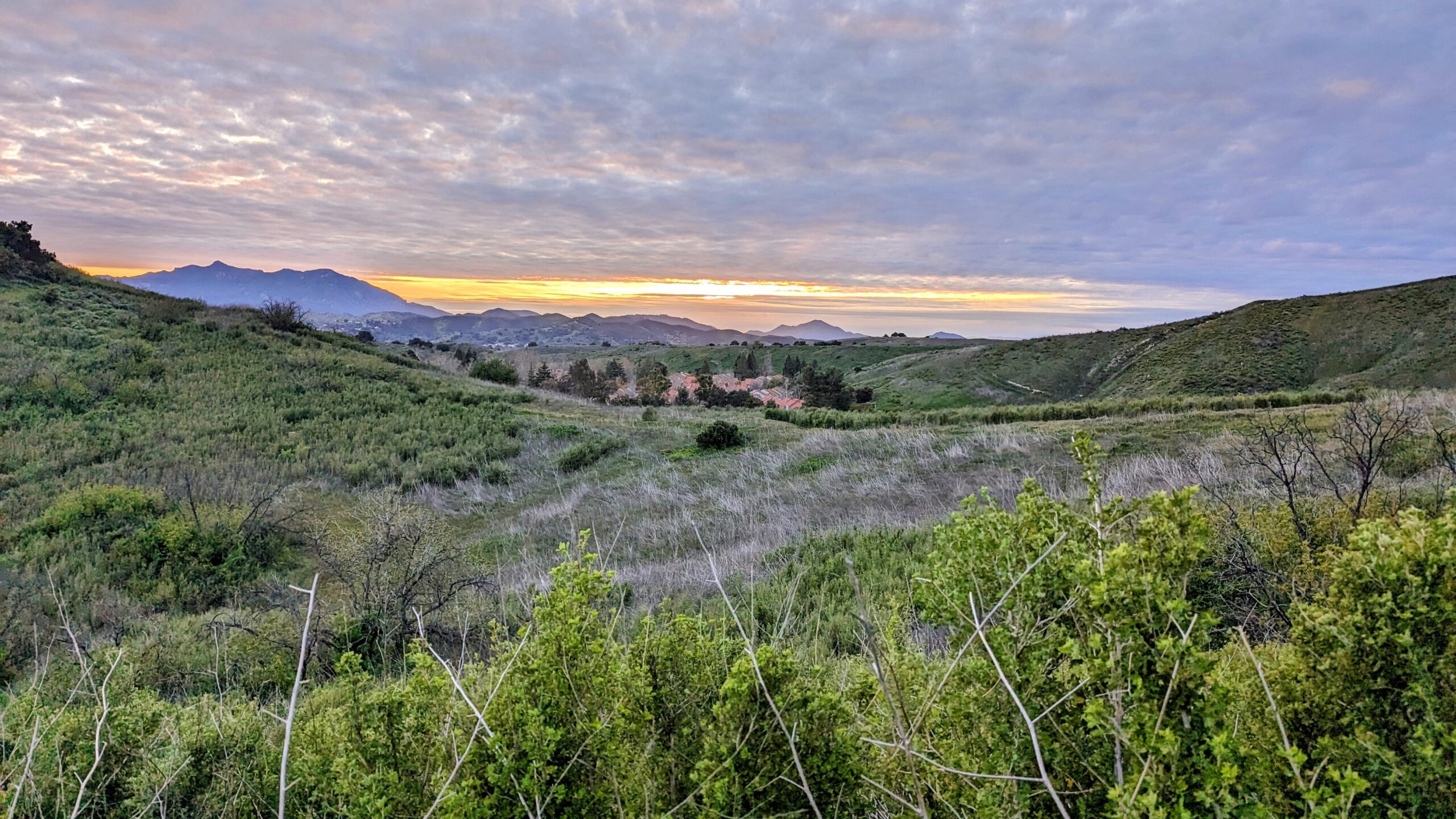
Let's head out to the famed Peace, Love, Joy arch at the Danielson. This out and back hike wanders through grasslands and chaparral from the Rancho Sierra Vista trailhead, then climbs up Danielson fire road for some fantastic views north to Port Hueneme and Oxnard and west toward the Pacific Ocean. If it's really clear,...
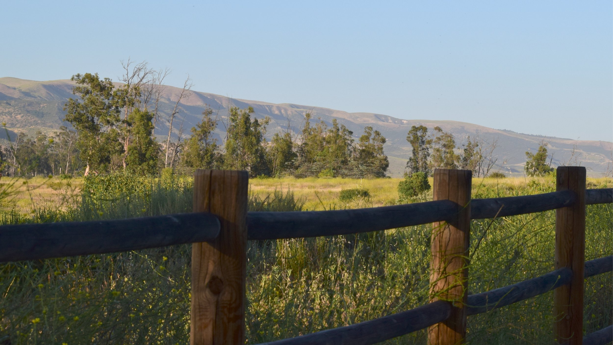
This is a moderate 4-mile hike in the foothills of the Santa Susana Mountains, with an elevation gain of 650’, suitable for fit beginners. The Hike My hikes are slow paced (1.5-2 mph) and the end time is approximate only. We take breaks, we explore, and we don't leave anyone behind. If this hike isn't...
Distance: 3.5 miles, Gain: 700', Intermediate. This was previously designated easy-intermediate, but some thought it should be labeled as intermediate because of the extended inclines. A strong and motivated beginner can do this hike. They would be challenged and slow during a few of these climbs. That's OK, because this is not a conditioning hike,...
5:45 PM START TIME - WEDNESDAY NIGHT I've been get too much couch time lately and need to get my tuckus moving, so here we go... This is kind of my "go to" hike, it's on my way home, it's not too long and the views can be spectacular! This is a great weeknight hike,...
This week: Arroyo Burro. Parking at the Water Processing Plant/Jesusita Trailhead off San Roque Road. This route follows Jesusita Trail for a little over 1/2 a mile, then bears left to Arroyo Burro Trail. The route meanders through private land on North Ontare before ascending a steep power line access/fire break road to the single...
We will start this hike at 8:30 because it is getting warmer. We will start at Santa Rosa parking lot, cross the bridge over the water and hike down to the new bridge. So we will not start up the road in the parking lot, instead we will cross over the bridge and go to...
If you've ever read "Wind in the Willows" you'll know just how much fooling around in beautiful creeks and rivers plays a part in the story of Mr. Toad and his friends. This hike will follow the various forks of the Arroyo Conejo and Indian Creeks around Wildwood Park. On Sunday, the creeks were flowing...
A silhouette following me down the Chumash. Looks Canadian. The pic is from the top of Chumash trail on Jan 15, 2025. Thank you Jimbo WhereAmEye (Tall Mark) has been doing this hike up the Chumash Trail in Simi Valley every Thursday night since the Jurassic Period, and he'll be leading this event until the...
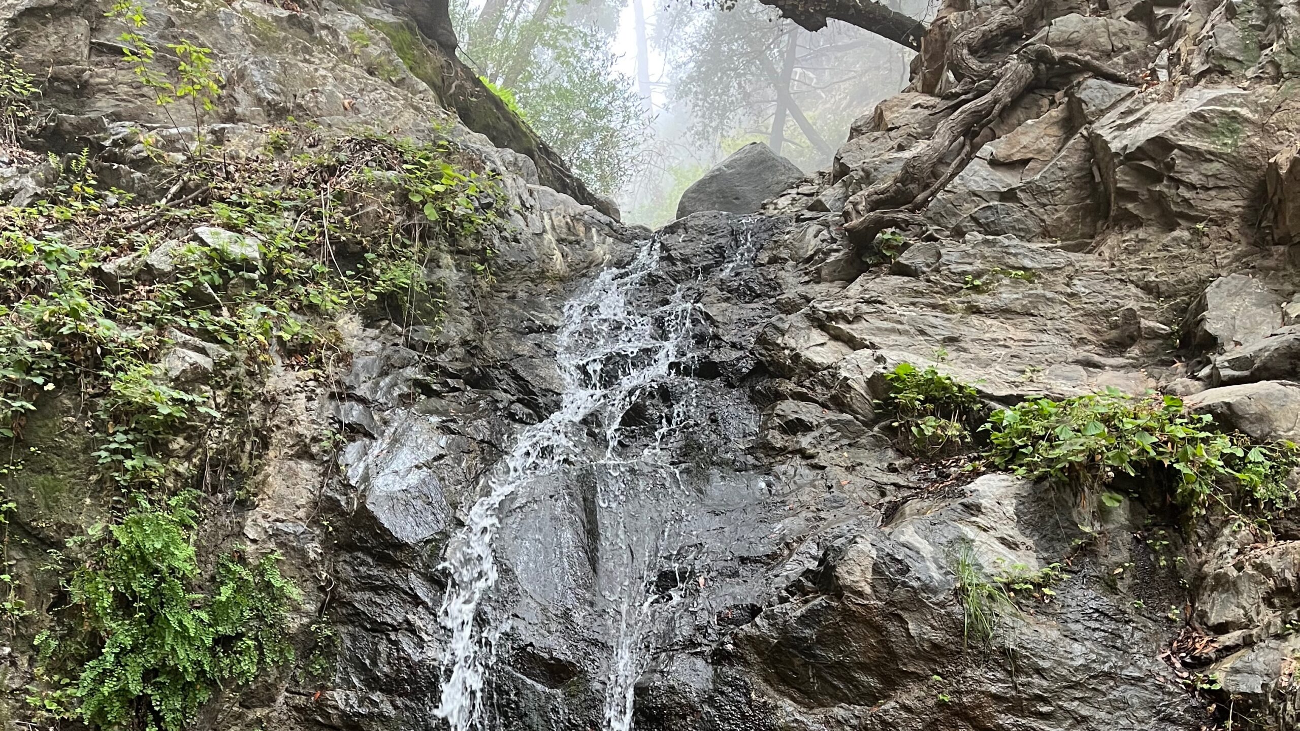
Come join me at Placerita Canyon Nature Center for an afternoon hike on the Canyon Trail and then go further to the waterfall. There was water a few weeks ago when I hiked it last, hard to say if the waterfall is still there as it has been warm and dry the past few weeks...
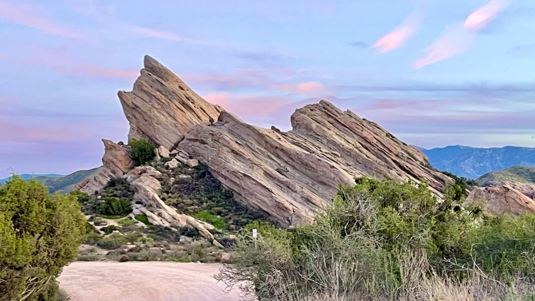
Let's burn off those Valentine Day chocolates on one of my favorite trails at Vasquez Rocks. This is a moderate 5-mile hike with an elevation gain of about 554’. The Hike My hikes are slow paced (1.5-2 mph) and the end time is approximate only. We take breaks, we explore, and we don't leave anyone...
Fit Beginner - 4 miles, 600' gain The gain is well distributed, with half being on the return. We start at the Las Flores trailhead where Las Flores dead-ends at Wildwood Park, and head west. After 1/3 mile, the trail becomes Wildwood Canyon Trail. We continue for another 2/3 mile and cross a bridge just...
Sooth your SuperBowl disappointment or temper your Valentines Day exuberation with a hike up the Rocky Peak trail Sunday afternoon. Pic is Sunset on the Rocky Peak trail Oct 2023. Thank you Teka, WhereAmEye (Tall Mark) has been doing this hike in every Sunday afternoon for over 20 years, and he'll be leading this event...
An HWD Classic! This hike is sponsored by Amazon - https://amzn.to/2GnCP0a During the 1950s, when Ronald Reagan hosted TV's "Death Valley Days," he wanted a more rural retreat than his home in Pacific Palisades. So he bought a 305-acre ranch in the hills of Malibu as a place to raise thoroughbred horses and dubbed it...
This hike starts at Gold Canyon Trail to Wildwood Canyon Trail and passes through various trails with a long creek, crossing streams and bridges, Indian caves, volcanic rock cliffs, water falls, cacti-filled desert environs, riparian forest, and wildflowers. Highlights of the hike include waterfalls incorporating 40’ Paradise waterfalls along tree canopies over approximately 5 miles...
This week: Mission Ridge (Tunnel Trail). This route ascends Tunnel trail for 2 miles then heads up the spine of Mission Ridge. Pause for refreshments and great city light views halfway along the Ridge. The Ridge trail follows the spine for 3/4 mile and drops off on an Edison access road. After a brief side...
5.75 miles, 700' gain. Easy Intermediate. Do not park on Potrero else risk getting a ticket. You need a permit to park on this street. Side streets such as Pinehill or Greenwood are good to park. This hike is a great trail when it might be muddy because almost the entire hike is on an...
A silhouette following me down the Chumash. Looks Canadian. The pic is from the top of Chumash trail on Jan 15, 2025. Thank you Jimbo WhereAmEye (Tall Mark) has been doing this hike up the Chumash Trail in Simi Valley every Thursday night since the Jurassic Period, and he'll be leading this event until the...
After the rain, the sun will shine! This is a 4 mile walk with an elevation gain of 700', suitable for beginners. Meet me at 6:00pm at Mammoth Highlands Park in Moorpark. We will walk to the Moorpark Country Club on Championship Road, and back. Bring water and a flashlight, it will be chilly so...
NOTE: Later time (10:00 AM) and different day (Friday) Since we have been inside for too long, I decided to post a hike for tomorrow, Friday 2/20. The hike will be on asphalt only and we will be limited to about 400 feet elevation gain. Hopefully, we will get in about 5-6 miles by making...
An HWD Classic! This hike is sponsored by Amazon https://amzn.to/2GnCP0a During the 1950s, when Ronald Reagan hosted TV's "Death Valley Days," he wanted a more rural retreat than his home in Pacific Palisades. So he bought a 305-acre ranch in the hills of Malibu as a place to raise thoroughbred horses and dubbed it "Yearling...
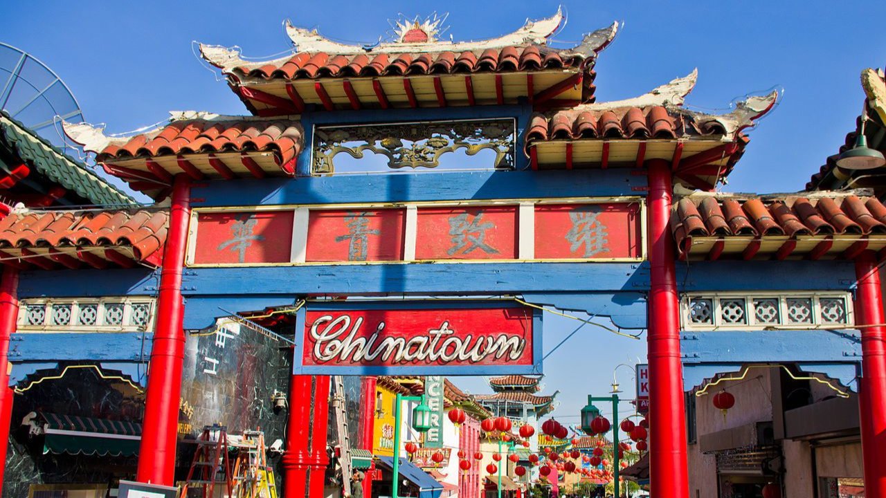
Join us for a bicycle ride this morning from North Hollywood Metro Station to Chinatown for Chinese New Year. We will depart at 9:00AM. QUALIFICATIONS: This bicycle ride is 31 miles roundtrip from North Hollywood to Chinatown, but you can ride your bike one way and take the Metro back if you want a shorter...
Kick off the 2026 5 Peaks Challenge with Gaviota Peak! The Santa Barbara County Trails Council has officially launched the 2026 5 Peaks Challenge! You have until May 1st to complete 5 of Santa Barbara's most iconic summits, and this hike is the perfect opportunity to get started! This peak offers an incredible view of...
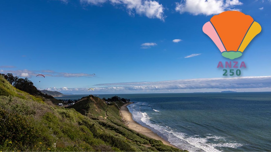
Join the Trails Council for a five-mile living heritage trail hike from Rincon Beach County Park to Santa Claus Lane on February 22, 2026. Walk in the footsteps of history as you follow ancient Chumash trading routes later traveled by the Anza expedition. In 1775–1776, Juan Bautista de Anza led 240 migrants—including families with women...
3.5 miles, 600' gain, Easy Intermediate Easy Option: 2.4 miles, 285' gain, Fit Beginner We enter the Los Padres trail through a spooky oak covered section, then move through until we come to a dead end. We'll turn right, and continue climbing up. We'll come to another junction, where we'll turn right onto the Los...
"Satwiwa" is Chumashan and directly translates to "the bluffs," which can also translate to "higher places," and is the Chumashan name used for a former village near the current culture center. The Ranch Overlook Trail extends from just west of the culture center to the Palomino Trail in the Rancho Potrero Open Space. https://www.conejovalleyguide.com/dosomethingblog/ranch-overlook-trail-in-rancho-sierra-vistasatwiwa-in-newbury-park This...
Encinal Canyon is named for encina, the Spanish word for the holm oak, a lovely Mediterranean tree with holly characteristics. Holm oaks are one of the main trees used to establish truffle orchards, but we'll be nosing around the canyon strictly for its beauty. The trail from Encinal is a smooth, firm, and well-traveled single...
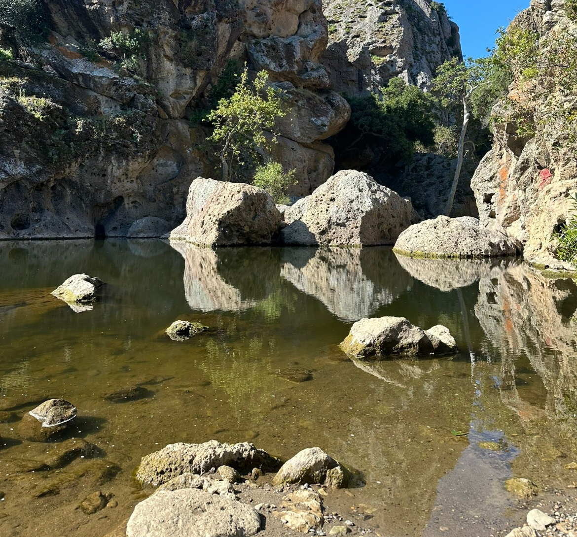
Beautiful walk through grasslands the rock pool, just beyobd Is a Rock Wall that is popular with local rock climbers. The movie Planet of the Apes (1968) was shot here! lGrasslands Trail to Rock Pool - Malibu Creek State Park on AllTrails https://www.alltrails.com/explore/recording/afternoon-bike-tour-at-grasslands-trail-d84210a?p=-1&sh=gyaqyb 3.2 mi 308 ft Out/Back Free street parking at trailhead.
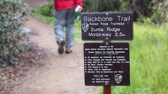
http://photos1.meetupstatic.com/photos/event/b/a/2/4/event_99467652.jpeg The waterfall should be flowing. Please bring a flashlight or headlamp as we may return in the dark. From the Kanan Rd trailhead, we'll jump on the Backbone Trail for a cruise down into Newton Canyon. On our way there, we'll cross the creek, pass under an oak canopy, and come out into an...
5:45 PM START TIME - WEDNESDAY NIGHT - No Rain This Week!!! I've been get too much couch time lately and need to get my tuckus moving, so here we go... This is kind of my "go to" hike, it's on my way home, it's not too long and the views can be spectacular! This...
This week: Rattlesnake to Flores Peak. We'll hike up Rattlesnake to the Meadow where we'll turn RIGHT up to Gibraltar Road. The hike to the road is 13% on average, but does have some brief 20%+ sections. Once we hit the road we'll turn LEFT and hike the road for about a third of a...
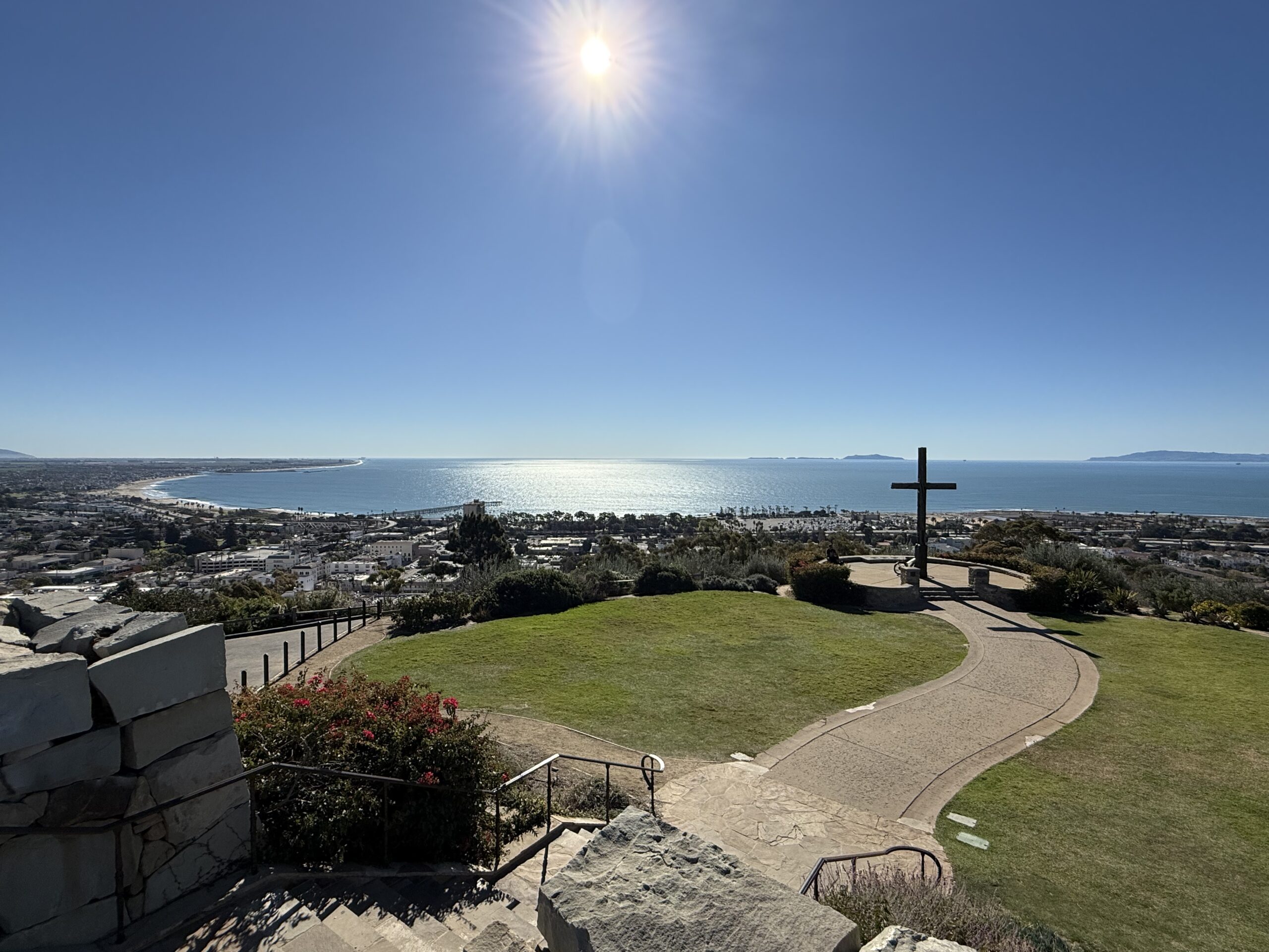
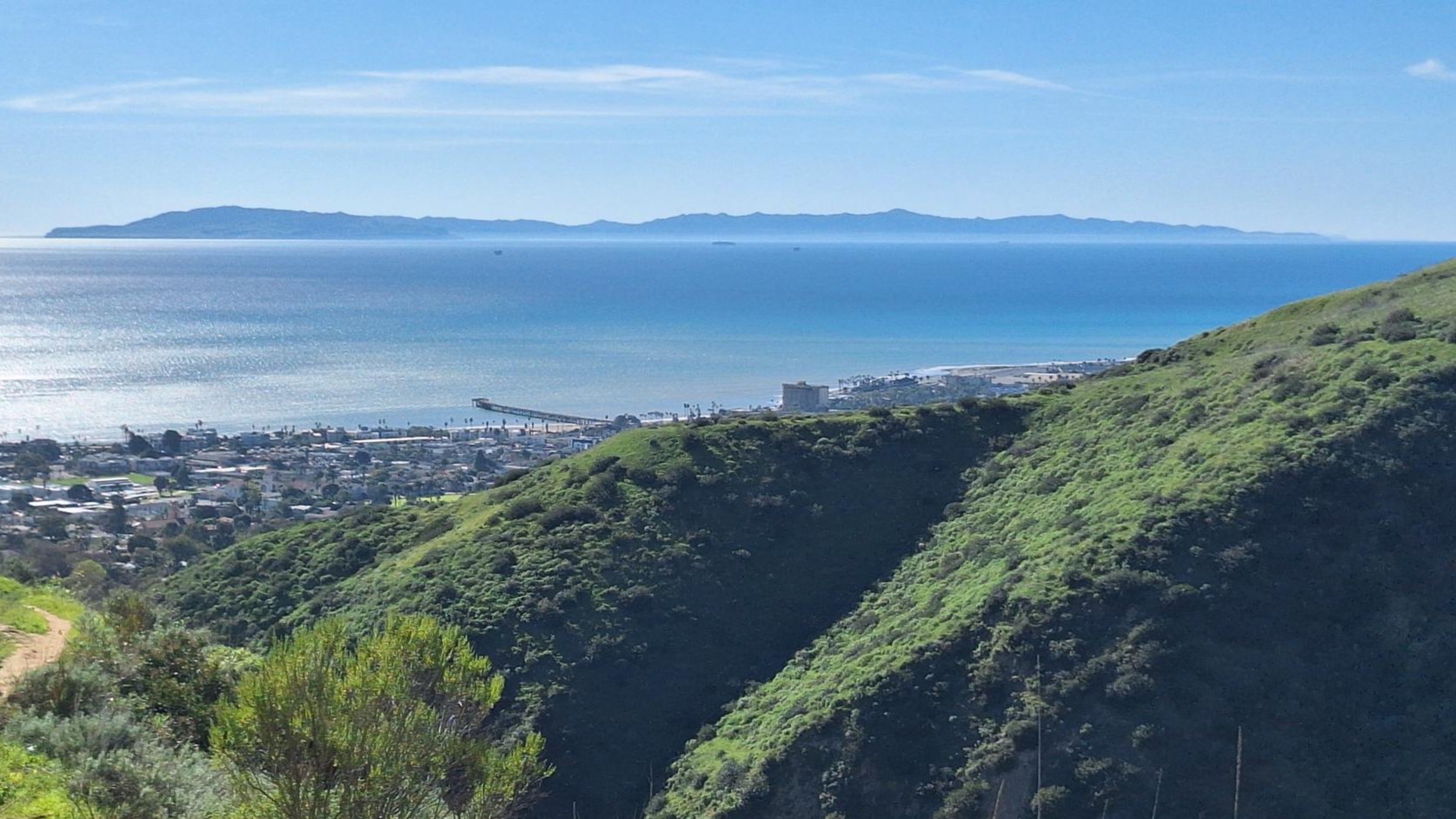
Ventura Land Trust has opened up a new trail in Ventura, just above the high school where the trail work has been going on for four years and it's finally open. The hike is similar to the Ray Miller Trail, i.e. It is 6 miles out and back. Right now it is a beautiful hike...
This week we’ll hike about 6 miles with 1100’ of total elevation gain, spread out nicely, with a little bonus loop through Oak Creek Canyon. This is a longer route than our typical gentler friendly option. "Robles" is Spanish for oaks, and we'll see plenty of them on this beautiful, relaxing hike. After a short...
A silhouette following me down the Chumash. Looks Canadian. The pic is from the top of Chumash trail on Jan 15, 2025. Thank you Jimbo WhereAmEye (Tall Mark) has been doing this hike up the Chumash Trail in Simi Valley every Thursday night since the Jurassic Period, and he'll be leading this event until the...
This is a relatively easy to moderate 4.8-mile out-and-back hike with an elevation gain of '800. Bring your binoculars or telescope because we're in for a treat as Mercury, Venus, Saturn, Jupiter, Uranus, and Neptune will line up along the western horizon at dusk. FYI, the almost full moon and possible cloudy skies may impede...
Stay cool on our bicycle ride on the beach bike path from Marina del Rey to Redondo Beach. There's always a cool breeze at the beach, so come and get some exercise. E-bikes are welcome too! This beautiful beach bike ride is 26 miles roundtrip on flat bike paths and roads. See a map of...
Please join us! We have a nice group coming. E-bikes are welcome! STAY COOL on our bicycle ride on the beach bike path from Marina del Rey to Redondo Beach. There's always a cool breeze at the beach, so come and get some exercise. This beautiful beach bike ride is 26 miles roundtrip on flat...
3.0 miles, 800' gain, easy-intermediate. Moonrise 4:17 pm, Sunset 5:51pm Photo by Helen Let's enjoy the gorgeous sunset, full moon, and fun loaded potluck picnic at the beautiful Angel Vista! This is a potluck hike. Please bring food, drinks to share. If your item requires utensils/plates/toothpicks, etc., please bring them. You may wish to bring...